The Elwood Canal, unlike Melbourne’s, Coode and Railway Coal Canal, is not a transport canal and has never seen or will ever see a commercial
Ship or barge.
It is what I term, a development canal and originally at 1320 yds long a very small one at that.
Over several years whilst travelling east out of Melbourne’s City,
I had noticed a number of small open boats moored in a bizarre,
canal like channel. This waterway was plonked down in the middle of one of the cities older inner suburbs and appeared to be devoid of function.
On investigation this turned out to be the Elwood Canal.
So further examination became imperative.
I only managed it in February, this year.
The canal itself, started life in May 1889 as the proposed focal point for one of Melbournes many coastal marshland reclamation projects intended for residential development.
As such it was probably Australias first completed residential canal.
“Patterson Cut” further around the bay was first dug in 1878 however the area was never developed as a recreation/development waterway system until the mid 20th century.
By the 1860’s the area was known as the South Swamp and was fed by the Elster Creek. This in turn drained into Port Philip Bay, at a small inlet along the St Kilda foreshore at the foot of Point Ormond.
Parts of this foreshore were also to be reclaimed in the proposed development.
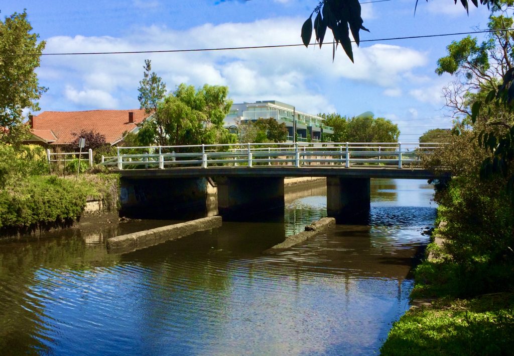
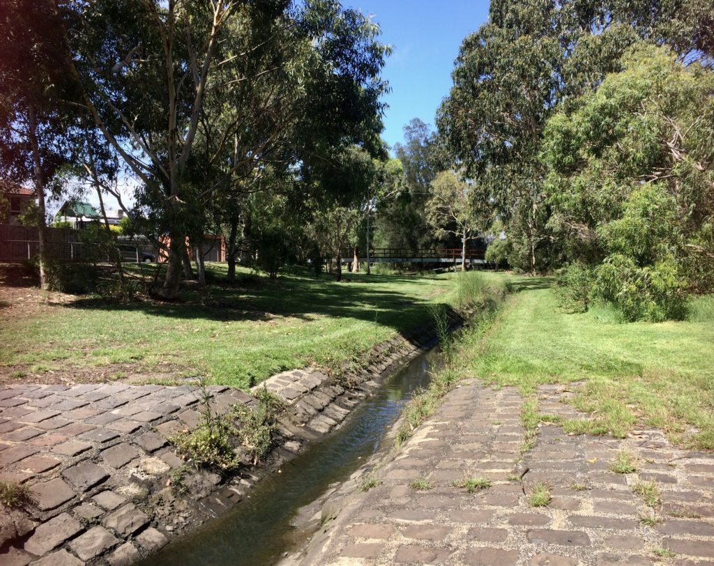
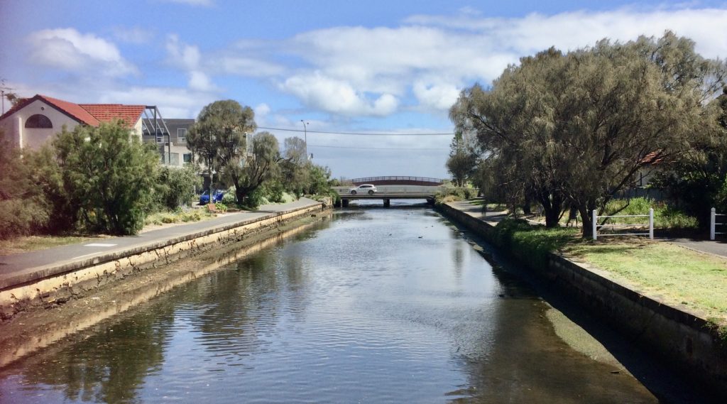
Glen Huntly Road Bridge in the background.
The real origin of the Canal goes back to Victorias fear of a Russian invasion in the 1860’s.
As a defensive measure coastal artillery batteries were positioned around the foreshore of Port Philip Bay (including at Point Ormond and Point Melbourne). These were probably supplied with ammunition from Jacks Magazine on the Saltwater River.
During 1887 the local Mayor petitioned the Victorian government for a military road to allow the guns to be moved round the foreshore in the event of an invasion. Part of this road later became known as Marine Parade.
Development of the South Swamp and thus the Elwood Canal was
a Victorian government attempt to recoup the cost of this road.
The canal proper commenced at what is now Glen Huntly Road Bridge
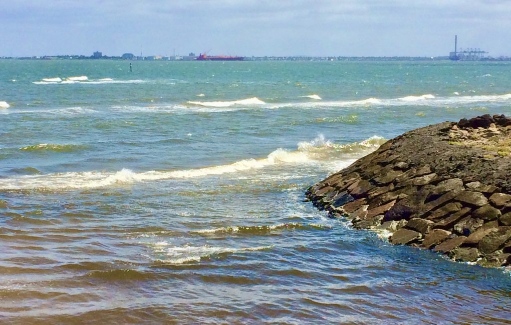
and ran into Port Philip Bay at what is now Point Ormond Reserve.
Its original function was to be part linea landscape feature, part storm water overflow drain and part boat mooring haven, however it soon became something of a White Elephant as it was neither designed nor maintained properly.
The original plan was to dredge the creek and use the dredgings (together with some from the Coode Canal) to build up the level of the adjacent swamp with the resulting channel being used for recreation
and flood relief.
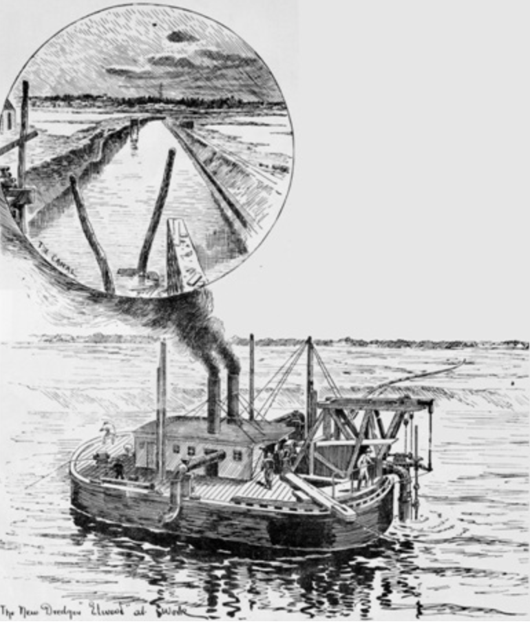
Illustrated Australian News, 1 August 1889
Normal land drainage water was to pass through pipework running underground adjacent to the canal with the canal only taking overflow water in time of flood.
However the adjacent drains soon became blocked due to poor design and lack of maintenance and flood water was funnelled down the canal channel which was too small to contain it.
The main channel also became silted by debris being washed down stream and settled where the fresh water flow met the tide.
This all resulted in the canal overtopping and adjacent properties were flooded on a regular basis right up until the late 1950’s. This in turn hindered residential development.
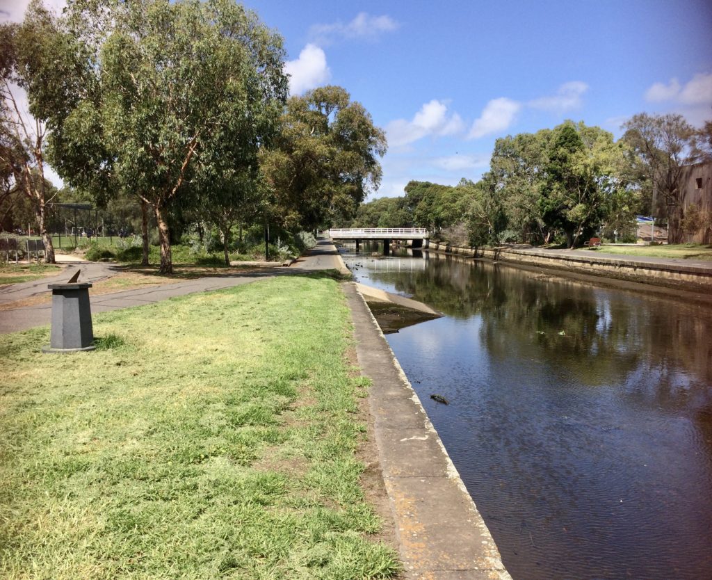
The top canal section from Glen Huntly Road down to the next bridge at Broadway contains what recent heritage studies describe as, two concrete boat ramps (that can only be used when the tide is in).
The channel itself was completely rebuilt in brick and concreted around 1904 as part of the effort to stop the flooding.
This work was still not totally successful and it would seem to me that the so called boat ramps could in fact have been put in during the 1930’s when even more flood mitigation works were carried out.
In reality the full length of the canal can only be navigated by very small boats or canoes at mid to high tide.
This is due to the low height of the original bridges and the later addition of a concrete bed which further reduced the headroom.
I suspect the ramps were actually built to allow mechanical plant access to the canal bed at low tide to remove silt build up at the, fresh/tide interface.
bridge where the canal becomes non tidal.
As part of the works to try and prevent siltation of the canal, the old creek bed above Glen Huntly Rd (The tidal limit) was widened to 130ft (39.6m).
A Bluestone channel was then run down the centre to take the permanent Elster stream water and grass sloping sides were formed to give a floodway depth of about 3ft (900mm).
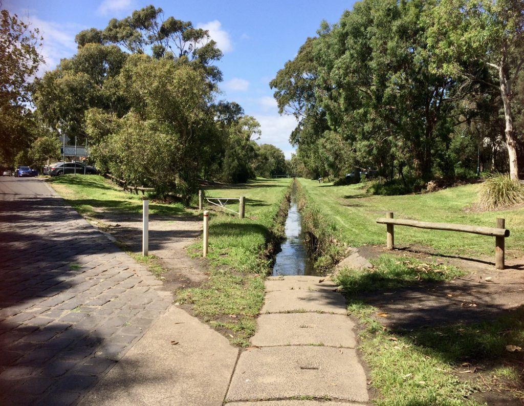
above Glen Huntly Rd
This work was completed up to Gardenvale railway station in 1907.
Note:-
This section is often erroneously referred to as Elwood Canal and the high flow rates referred to as the Elwood Canal flooding.
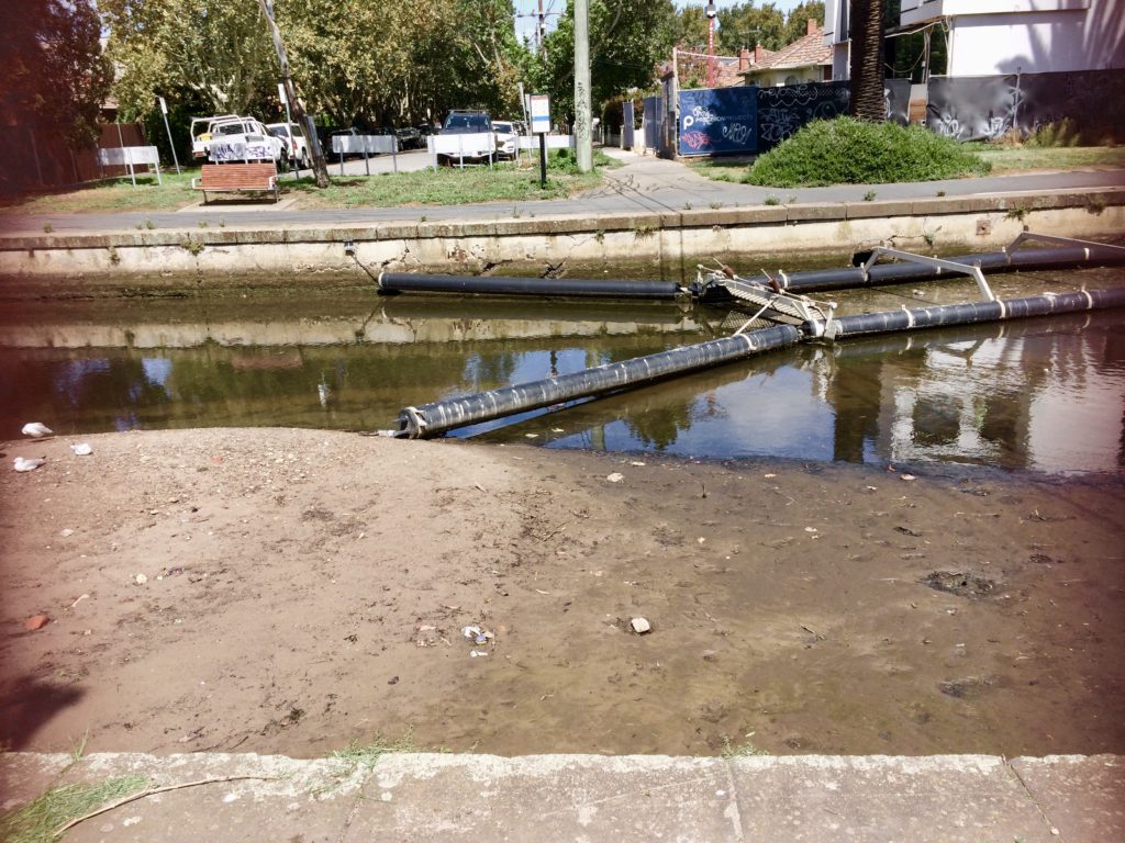
between the canal wall and silt deposits.
It can be seen above, how silt build up is still a significant problem adjacent to Goldsmiths St. More or less where tide meets run off. However the water authority seem to be using it as an integral part of their rubbish collection system.
As the canal still floods on occasion I can’t help but think there is still a connection with silt deposits. In addition both the silt and the rubbish trap are unsightly, particularly at low tide.
Surprisingly despite this being an urban waterway, apart from the odd traffic cone the canal contained very little urban rubbish at the time of my visit.
the post 1960’s gentrification of the canal side.
Up until the 1960’s the canal environs suffered from a number of disadvantages. In addition to the regular flooding, these ranging from noxious fumes emanating from local industry, to the canal being used as a rubbish dump.
In 1936 the canal was accused of being the cause of a polio epidemic and the local school was closed for a period in 1937.

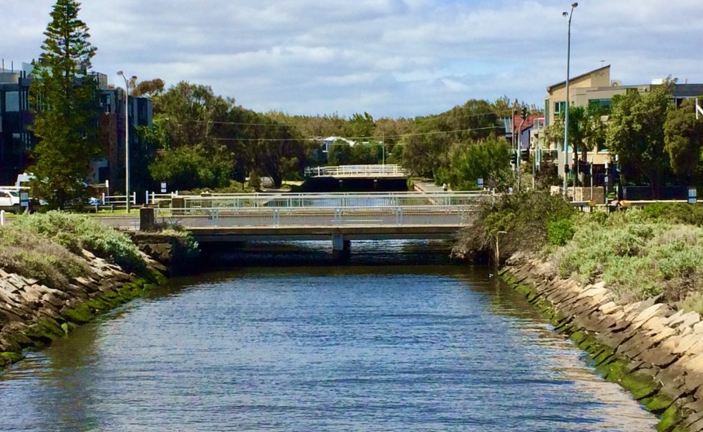
Original canal bridges were at Marine Parade, Barkly, Addison, Ruskin Streets, and Broadway. The original concrete decks were built on iron beams which were then supported on brick piers.
Engineer John Monash, later designed six Reinforced Concrete bridges over the watercourse. One over the Main Drain up stream of the actual canal at St Kilda St (1905) still exists and is claimed to be the oldest RC bridge in Victoria.
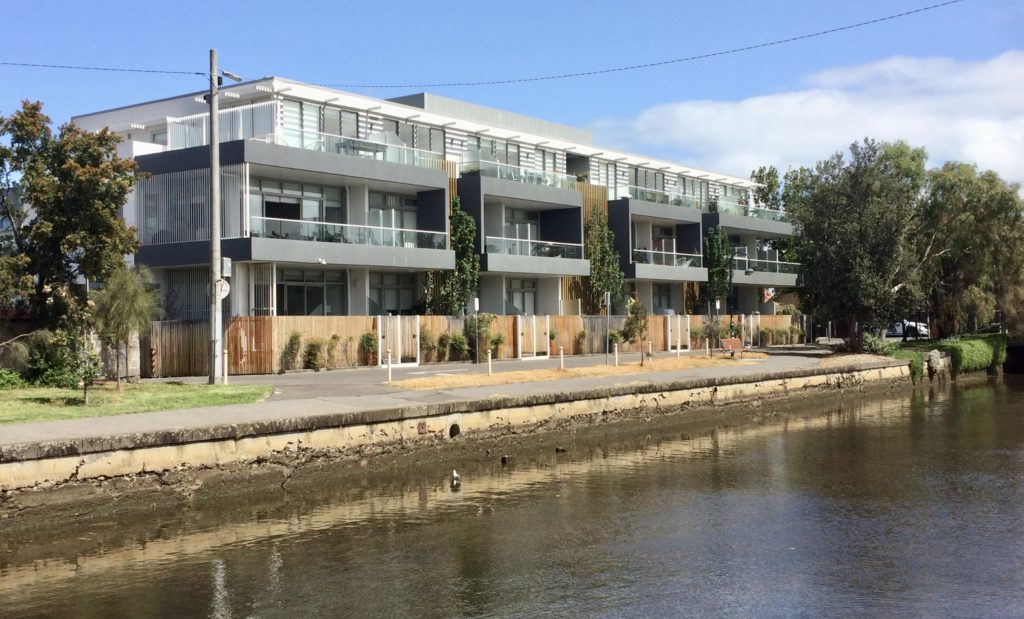
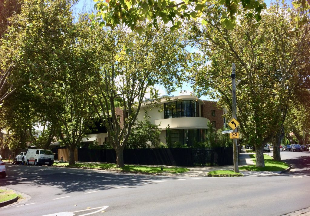
New residential developments are only just beginning to address the full visual benefits of the canal-way.
Within the original reach above Marine Parade bridge cast iron mooring rings and steps can still be seen cast into the concrete walls of the channel.
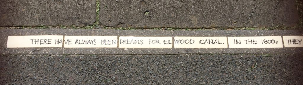
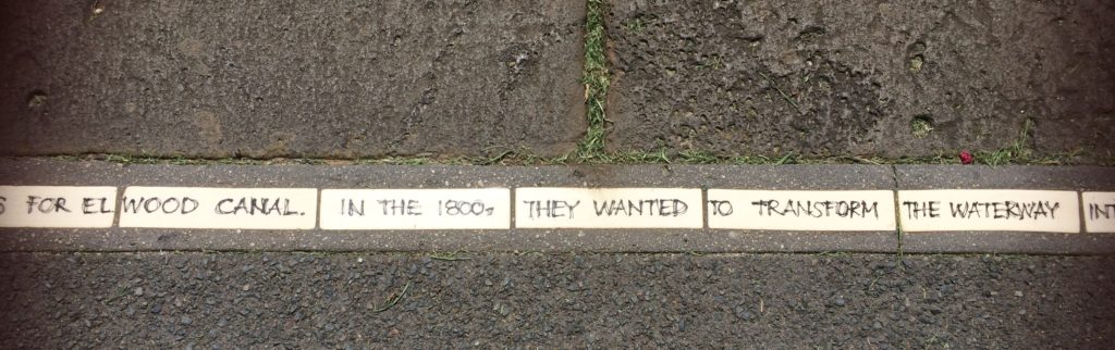
As a community art project a number of printed tiles have been set into the footpath along the east canal edge which relate comments from local residents. (other comments have also been included in italics)
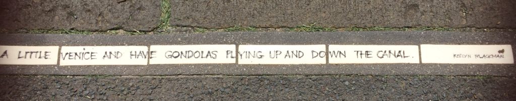
Another inscriptions reads:
There used to be more than thirty boats anchored along this part of the canal. You can still see the rings in the wall. At 5pm everybody used to go out fishing. My grandfather used to lower me down here (the canal) to catch worms. When it was time to get out I’d hang onto the end of his fishing rod and he’d haul me out.
Marine Parade bridge from Cribbs foot bridge.
During 1967 the original bridge carrying Marine Parade was demolished and replaced by two new very low concrete dual carriageway crossings.
In order to make this possible about another 45 acres of land were reclaimed from the bay.
Ironically, the new low bridges not only prevented boat access to the canal but they are also the only bridges that are shown on the local flood map as being subject to inundation. (So much for improvement!)
Of this 25 acres was set aside for recreational use and this necessitated the canal being extended toward the bay by about 200 yards.
At about the same time as these roadworks were taking place the general financial climate in Australia was making it possible for large scale up market recreational boat ownership to occur.
By coincidence local business interests had also identified a need for modern boating facilities in the Port Philip Bay area to service this need.
After much wrangling between residents, business and the local council 20 acres of the reclaimed land were allocated for the construction of a new St Kilda Marina adjacent to the new Moran Reserve, this was built in 1969.
It should be noted that the St Kilda marina was purpose built and modelled on the latest North American design standards. It incorporated all the facilities that modern boaters now take for granted. However in the 1960’s it was cutting edge.
It is now recognised as being the first of its kind in Australia.
from Marine Parade
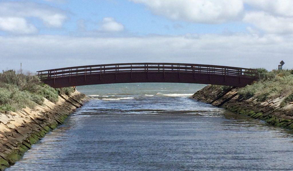
During 1972 the canal extension was widened and lined with rocks and the reclaimed land landscaped. The reserves each side of the extension are now well used for recreation. In 1998 the laminated timber John Cribbes footbridge was built to link the two reserve areas without the need for pedestrians to use the Marine Parade main road bridge.
A second similiar bridge of steel soon followed for use by cyclists.
Conclusion
This canal is best described as an interesting and pleasantly landscaped engineering folly. It never quite managing to achieve its flood relief function. Other large engineering works being necessary for this. Headroom under later bridges, then making it impractical as a boat haven.
Finally due in part to flooding and the flood mitigation works required the land sales failed to compensate the Victorian Government for the cost of building the original military road.
Elwoods waterside environs are best enjoyed on foot (or bike). Good asphalt paths are provided from St Kilder St and Glen Huntly Road to Point Ormond Reserve. The canal can be walked in 30-40 minutes with ease. Or the trip could be extended along the sea front to the Marina or up to St Kildar St if desired.
Great to be browsing your weblog again, it continues to be months for me.
Thats a very good feedback. Im curious to think what type of impact this would have globally? There are times when things like this begin to have global expansion and frustration. Ill check back to see what you have to say.
Pretty nice post. I simply stumbled upon your weblog
Please find attached copy of old map/course of the Elwood canal.
Aw, this was a really nice post.
Hi there, MegaCool blog mate, I really loved this page.
Stubbmled accross your blog and decided to have a very quick study, not what I usually do, but I found this blog excellent. Great to see a web site that has great content, and actually makes some sense. Anyway, great write up.
I just added this website to my favorites. I really like reading your posts. Tyvm!